SkyNode
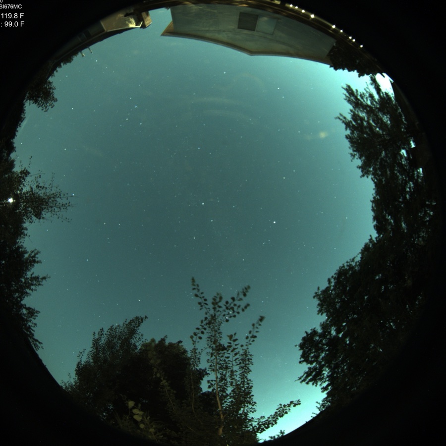
SkyNode answers the question a forecast can’t: what does the sky over the rig look like right now? It reads your sky photometrically through an all-sky camera: ARIS detects clouds live and paints them where they matter — on the Plan sky chart, over your actual targets — and certifies whether the sky is genuinely clear or quietly overcast.
Three ways in
Section titled “Three ways in”ARIS meets your camera where it is. Any camera-plus-brain feeding ARIS sky truth is a SkyNode, and there are three ways to run one — one available now, two on the way. All of them feed the same sky intelligence to your rigs.
Through the all-sky setup you already run
Section titled “Through the all-sky setup you already run”If you have an all-sky setup capturing frames tonight, ARIS plugs into it. Install the ARIS companion service on the machine that runs your camera — the rig’s own computer or a separate one — and it analyzes the frames your existing software is already producing and publishes sky intelligence to your rigs. Your current capture stack, keograms, and time-lapses keep working untouched.
This is the path everything on this page describes, and the full walkthrough is in Set Up SkyNode.
Plugged straight into the rig
Section titled “Plugged straight into the rig”Direct raw-camera support — where ARIS drives the camera itself, with nothing else to install — is rolling out. The all-sky camera plugs into the rig computer and becomes a third camera role alongside your imaging and guide cameras, with ARIS running its exposure through the day/night cycle automatically.
The dedicated SkyNode
Section titled “The dedicated SkyNode”For sites where the camera can’t reach a computer by cable, a dedicated SkyNode device is in development: a small Wi-Fi node built on a $25-class Raspberry Pi board that carries the camera and joins your network the way a phone does, while your rig computer does all the thinking.
Starting from zero hardware? Choosing a Camera for SkyNode covers what actually matters — sensor, lens, mounting — and what to skip.
What you get
Section titled “What you get”Clouds on your sky chart
Section titled “Clouds on your sky chart”Cloud detection is rendered on the Plan view in true altitude and azimuth: ARIS fits your camera’s actual lens projection, so a cloud bank in the western sky lands over the western targets on the chart. You see at a glance which targets are clouded out and which side of the sky is still open, instead of squinting at a fisheye image and doing the mapping in your head.
Absolute sky state
Section titled “Absolute sky state”Frame-to-frame comparison catches moving clouds but misses the failure mode that ruins nights: a uniform cloud sheet that parks over the site and stops changing. ARIS keeps a photometric clear-sky reference and certifies the current sky against it, producing an absolute verdict — clear or overcast — that catches even a featureless gray lid. The verdict appears on the SkyNode tile, and GUPPI can quote it when you ask about the sky.
Sky quality, measured
Section titled “Sky quality, measured”The same photometric calibration yields a sky-quality (SQM) reading — sky brightness in magnitudes per square arcsecond, the number dark-site maps and handheld sky meters report — derived from the all-sky camera itself. Instead of a separate meter, your site gets a running measure of how dark the sky actually is, from the same frames that drive cloud detection. And because it is computed only against true sky (see the mask below), a bright roofline or a floodlit tree never pollutes the number.
Your telescope, on the sky
Section titled “Your telescope, on the sky”The live fisheye carries a pointing marker for your telescope: an honest footprint of your imaging camera’s field of view, drawn at the right size in the right place on the sky, with a finder ring around it so even a tiny field stays findable on the full dome. One glance at the all-sky view answers “where is the scope actually aimed” — and whether a cloud bank is heading for it.
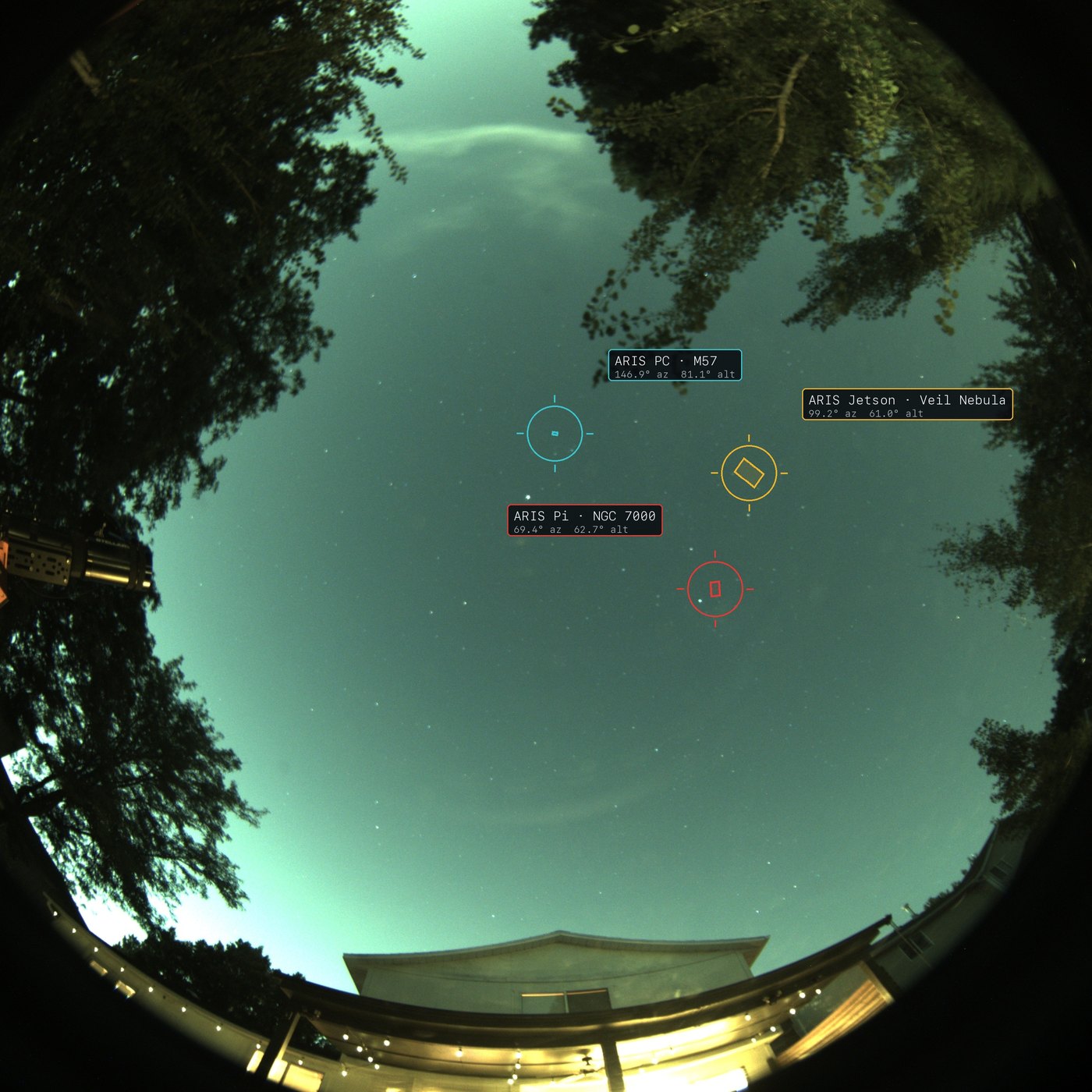
Three rigs on one sky, each rectangle drawn at its own true field of view --- 3.2° for a 648 mm refractor, 1.8° for a 738 mm, 0.7° for a 2800 mm SCT. The telescope at the left edge of that frame is the rig the red marker belongs to: because the target is astronomically far away and the camera is only metres from the scope, the tube’s direction in the image and its marker land in the same place. You can check the alignment by eye.
On multi-rig arrays, every rig gets its own marker: the full all-sky view and the home tile both draw one per rig, so “which rig is shooting where” is a single look at one sky. The same marker rides the all-sky view in a Go Live broadcast, so viewers can see where the telescope is pointed too.
Calibrated from the stars themselves
Section titled “Calibrated from the stars themselves”Placing clouds and markers correctly requires knowing the camera’s real geometry — which pixel corresponds to which direction in the sky. ARIS solves that from the night sky itself: a single clear night frame is matched against bright stars, solving the camera’s full geometry — all six parameters, lens projection included — to about 0.23° RMS. No hand alignment, no reference measurements, nothing to configure.
The calibration persists per camera, and on multi-rig sites it heals itself: a rig that has never seen the camera’s calibration pulls it from a sibling rig automatically, so a fresh device or reinstall doesn’t start from scratch.
It knows what a cloud is not
Section titled “It knows what a cloud is not”- Trees and buildings around your horizon are masked out automatically — a pine tree never reads as a permanent cloud in the south.
- The Moon is handled explicitly, so a bright moonlit region doesn’t register as cloud.
- Aircraft and satellites are rejected as transients — a trail crossing the frame is not weather.
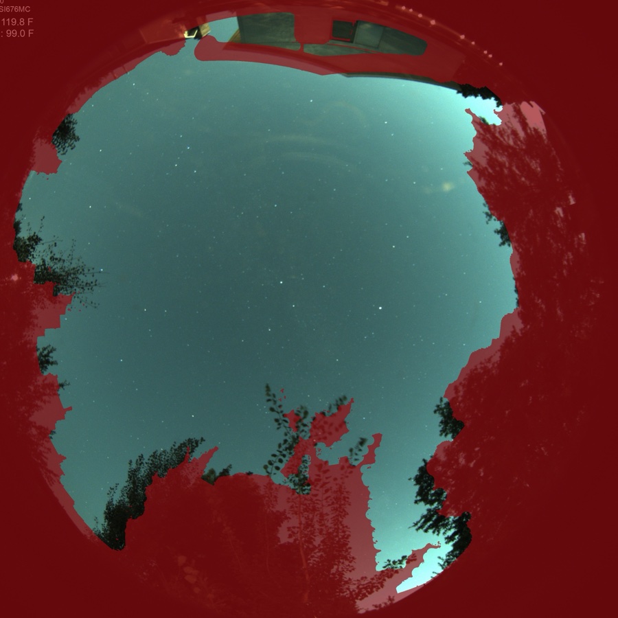
The mask above is a real one, learned automatically from this camera’s own frames. On this site the camera sees about 41% true sky — and that number is exactly what cloud detection, sky-state certification, and sky-quality readings are computed against. No hand-drawn horizon polygons.
Zero-configuration discovery
Section titled “Zero-configuration discovery”ARIS finds the camera’s companion by name on the network, falls back to its last-known address, and as a last resort sweeps the local subnet. You never assign a static IP, reserve a DHCP address, or touch your router — and the camera survives address changes without reconfiguration.
Where it appears
Section titled “Where it appears”- Plan screen — the cloud overlay renders as a layer on the sky chart, over your targets, in true alt/az.
- SkyNode tile — the live all-sky view itself. When the absolute sky-state verdict is overcast, the tile carries a veil and a chip saying so, so a gray lid is called out instead of quietly looking like a dark sky.
- GUPPI — ask GUPPI about the sky and it quotes the live verdict alongside the forecast.
- Guardian — Guardian night mode (opt-in) consumes the same sky state and corroborates it with guiding evidence before acting.
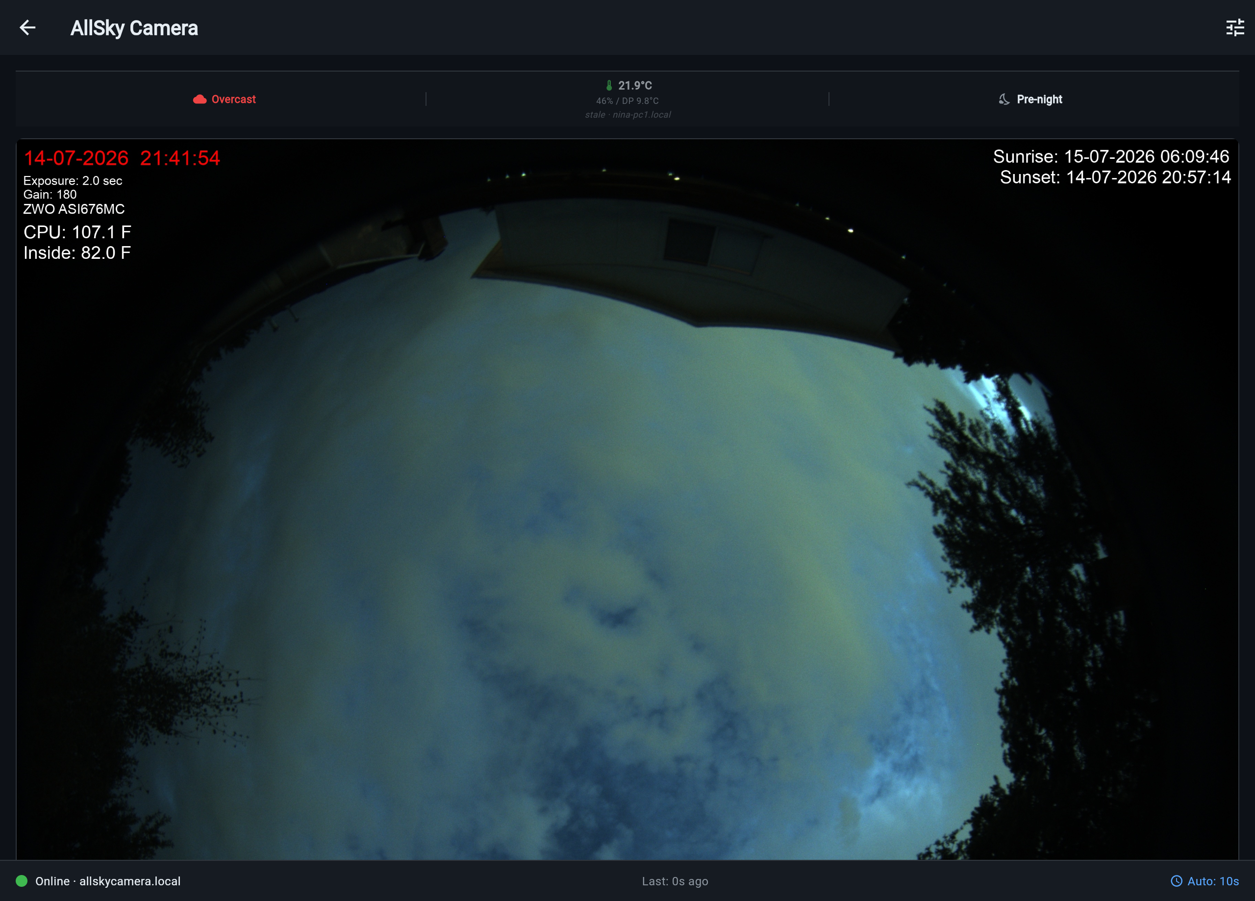
Cloud detection and the weather forecast are complementary: the forecast plans the hours ahead, SkyNode reports what is actually overhead right now.
Requirements
Section titled “Requirements”- An all-sky camera producing frames, with the ARIS companion service installed on the machine that runs it — see Set Up SkyNode for the walkthrough.
- The companion and your rigs on the same local network.
- Cloud detection works at night; the absolute sky-state verdict needs a clear-sky reference, which the companion builds from your own site’s clear nights.
The overlay and sky state appear on ARIS rig computers; NINA-based rigs do not consume SkyNode data yet (see NINA Integration).